Kerala University's innovative landslide warning app gets patent; poised for wider adoption
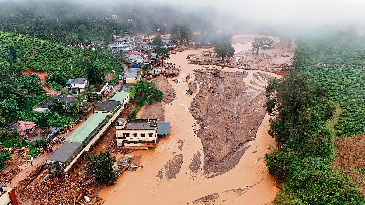
THIRUVANANTHAPURAM: In a groundbreaking achievement, Kerala University has secured a patent for its real-time landslide early warning system-Slope Instability Predictor-Kerala (SLIP-K)- marking the first time such technology has received official recognition in India. Developed by Dr Sajin Kumar KS, Assistant Professor in the Department of Geology and a leading expert in landslide research, SLIP-K is poised to revolutionise disaster preparedness in the state and beyond. The patent arrives at a critical juncture for Kerala, which has reported nearly 1,200 landslide-related deaths since 2018. The ongoing development of National Highways through hilly terrain continues to pose serious risks to motorists and local communities. SLIP-K aims to fill a longstanding gap in disaster preparedness by offering timely alerts based on rainfall and terrain data. This is the first patent granted to an early landslide warning technology. While similar technologies exist in other countries, our system offers near-real-time alerts. Users can tag a specific location on the map provided in the app to receive immediate alerts, said Dr Kumar. The mobile application uses geospatial mapping, automatic weather stations (AWS), and rainfall thresholds to issue alerts in four categories-green, yellow, orange, and red-depending on the severity of the risk. The app sends alerts every 15 minutes, providing continuous monitoring of landslide risks. Dr Kumar emphasised that both government agencies and private sectors-like resorts and plantations-could benefit from the system, with the latter able to customise alerts for their specific needs. Uttarakhand's devastating decade: 3,554 lives lost in 8 years of natural calamities Currently, the Geological Survey of India (GSI), the national agency responsible for issuing landslide warnings, is in discussions with Kerala University to incorporate parts of this technology into its own alert systems. GSI is refining its landslide alert mechanisms in the vulnerable areas of Wayanad and Idukki and plans to begin issuing public warnings within the next year. SLIP-K has already undergone successful field testing with the support of eight automatic weather stations (AWS) in Idukki, in partnership with the Society of Exploration Geophysicists (SEG) and Michigan Technological University. In 2018, Idukki reported the highest number of landslides in Kerala, with 2,223 of the total 4,728 landslides recorded in the state that year. Despite the district's high landslide vulnerability and a large population living in high-risk areas, Idukki still lacks a functional real-time warning system. We need at least 50 rain gauges to cover the entire Idukki region. Once fully implemented, the Kerala State Disaster Management Authority (KSDMA) can monitor landslide risks in every ward using this app, added Dr Kumar. The SLIP-K app uses geospatial data, real-time monitoring, and communication networks to issue color-coded alerts-green, yellow, orange, and red-based on the rainfall threshold and landslide susceptibility in the area. The app could become an essential tool for disaster preparedness, mitigation, and risk management. Wayanad landslide rehab: Confusion continues over township beneficiary list How SLIP-K works Tag Locations: Users can tag a location on the map for tailored alerts. Real-Time Data: The nearest AWS sends rainfall data to the system. Mapping and Alerts: Rain data is mapped to the area's susceptibility and alert thresholds, sending alerts every 15 minutes. Key benefits Disaster Preparedness: Enables better response and mitigation. Idukki & Wayanad: Both are landslide-prone areas with significant population density, making the risk to human life high. Real-Time Monitoring: A vital tool in a region where no effective alert system currently exists.

 29 C
29 C